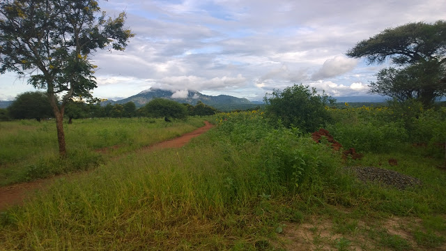
On the Road
 |
| En Route To Sandakan, A RestArea - Dec 2011 |
For me it was all "tidak apa-apa" (no worries) since I was already very familiar with its granite peak having reached the summit two years ago. For my buddy Jason, visiting Malaysian Borneo for the first time, the mountain's fickle nature was more of a nuisance. He kept his eyes fixed out the left-hand window hoping for a break in the clouds as I maneuvered the Myvi, from the right-hand side of the car, down from Kundasang into the broad valley that Ranau calls home.
A couple of hours from KK, we stopped to stretch our legs on the Canopy Walk at Poring Hot Springs and soaked in the cool air and sights of the mountainous rain forest. After lunch, the road led us away from Ranau, Mount Kinabalu, and places I was already familiar with. Ahead lay a couple hundred kilometers of terrain that I had only seen from a half-dazed state on a long-distance bus months ago.
We passed sleepy kampung villages with brightly-colored houses elevated on stilts and under the sun-dappled canopy of a large forest reserve. It was absolutely stunning - a wonderfully beautiful drive through tropical mountains. And then we got to Telupid and everything changed. . .
The rich diversity of the rain forest gave way to oil palms and plantations that stretched as far as the eye could see. Some sections were full grown while others had been recently planted. The most haunting were those that had recently been harvested, hectares of scarred red earth baking in the sun with scrub grass and weeds a poor replacement for the thousands of trees that had been ripped from the ground. I found myself wondering what this part of Sabah had looked like before this industry moved in. Had it been densely forested like the mountains we had just passed through or a highland plain instead?
The road changed too. What had been a smooth ride turned into an obstacle course of potholes, lorries loaded with oil palm fruit headed to the mills, and tankers loaded with oil headed for the coast. The highway, it would seem, was not built to handle the volume or type of traffic it is receiving. With natural resources being stripped and infrastructure being crushed by companies headquartered in Peninsular Malaysia and abroad and profits flowing out of the state, I wondered what benefit Sabahans truly receive from this extractive industry.
Approaching Sandakan town, the landscape shifted again. Coastal palm trees and industrial buildings were blooming along the outskirts of town. Moving closer to the city center we passed through the new developments of suburban Sandakan - shop lots, office blocks, and housing estates - as colorful plantings of flowers and shrubbery filled the median and roadsides.
Driving through downtown, while the streets are lively and the Chinese Shops, Noodle Houses, and Port are bustling during the day, one senses that the vibrancy of the city has moved away from the urban core. Passing through at night reveals security grills drawn across closed doors and streets that are largely empty except for pockets of migrant workers and the occasional 24-hour kopitiam or curry house. It is a very different city to navigate at night than brightly lit Kota Kinabalu.
+++
There is something about the open road that draws me in. . .
. . . The conversations, companionship, inside jokes, and little rituals that develop when you share the road and the enclosed space of a car with another.
. . . The way in which distant locales are physically stitched together mile by mile and lines on a map become populated with an unbroken string of images and impressions.
The combination produces, for me at least, powerful sense memories. . .
From summers spent shuttling youth across the United States on service trips to family vacations and Cedar Point runs with my brother (aka Grampa Tom), much of my life has been recorded on the road.
Sitting in a cafe in Kota Kinabalu, half a world away, I can still see the sunrise over Southeast Wisconsin and the way in which the skyscrapers of Chicago give way to the smokestacks of Gary. My minds eye flies along open spaces as the agricultural lands of Indiana and Ohio gently rise to become the mountains of Northern Pennsylvania. I move ahead as the Poconos fall behind at the Delaware Water Gap just as you prepare to cross the George Washington Bridge into the heart of Manhattan on your way to to the Elm City in Southern New England. Along the way, roadside signs and exit ramps mark not just miles but a succession of memories and histories both personal and public.
Beyond my own story, as I read it, the landscape, traversed on the open road, tells a story about the natural world, about the individuals and communities who have settled along the way, and about the subtle connections and divisions between them. With Hong Kong action flicks playing on video screens, it is a story easily ignored on express buses and one that is all but impossible to capture when flying at 30,000 feet overhead.
While remarkable in its own right for being my first drive across the state, the power of this road trip is the way in which it has begun to shift my understanding of this place that I am beginning to identify as a second-home. I'm learning to read the landscape and the lines between people and place(s) in a new way. Even as the route becomes more familiar -mundane even- in the months and years to come, I trust that the story it tells and the collection of memories it is bound to contain will only become more complex and fascinating.


Comments